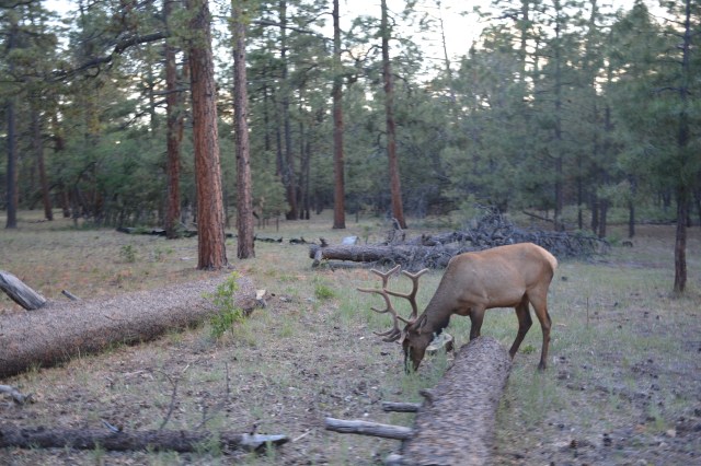
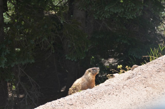
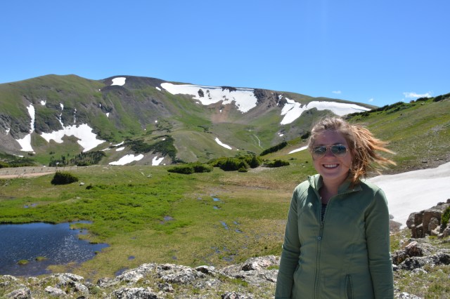
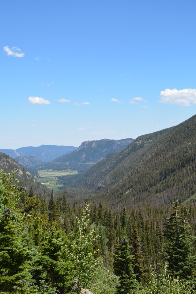
After five weeks, I’ve come to the realization that about every 7-10 days we need some city time and, more importantly, some hotel time. After Black Canyon, we headed to Denver for a great meal at Kona and a relaxing night in a hotel. Then – on to Rocky Mountain National Park. Sarah and I were just there in August so we didn’t feel pushed to see everything while we were there. We drove the Trail Ridge Road from east to west, using the one-way gravel Old Fall River Road as our route to the Alpine Visitor Center. We continued on almost to Grand Lake then turned around and drove the paved road all the way back. On the way we saw this critter on the side of the road. At first, he was laying flat on the edge of the road, looking like roadkill. Then he popped up for Sarah to take this picture.
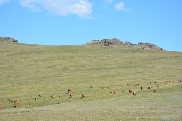
We saw two herds of elk on the drive as well as these two big guys.
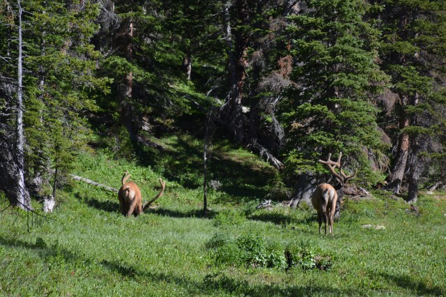
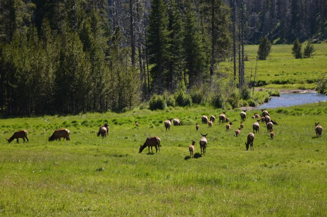
 As always, the drive was beautiful. There was some snow in the high country and it was really WINDY!


 No pictures but on our last full day of vacation – before we started the trek home – we did a whitewater raft trip on the Cache la Poudre River out of Fort Collins. We chose a trip with Class II and III rapids and kind of wish (well, Sarah wishes) we’d chosen the trip with Class IV rapids. Still, it was a memorable way to wrap up a great trip!


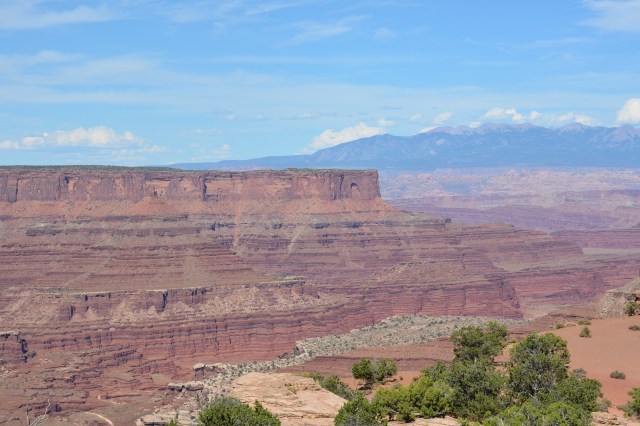
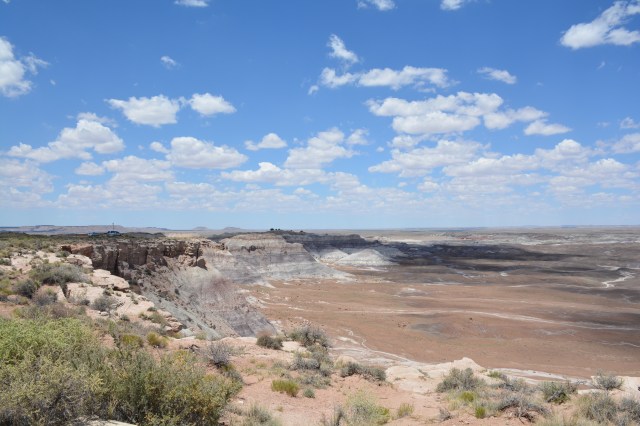
 I mentioned in an earlier post that we were probably not doing the Utah parks justice since we were limited on time. We visited Canyonlands on the same day as Arches so we weren’t able to spend a lot of time here. Canyonlands has three distinct districts – Island in the Sky, The Needles and a four-wheel only remote area known as The Maze. We entered from the north so spent our time in the Island in the Sky area. We drove the scenic drive and did a quick hike to Mesa Arch which was really picturesque, however, there were a lot of people there so we weren’t able to get a good picture of the entire arch without someone else’s family in the picture.
 A good part of the credit for establishing Canyonlands National Park is due to Stewart Udall’s leadership as the Secretary of the Interior in the 1960’s. Interpretive signs at the park indicate that Udall was flying over the area with the chief of the Bureau of Land Reclamation when the chief said he wanted to build the “next big dam” near the confluence of the Colorado and Green Rivers. Udall thought the area was better suited for a national park.
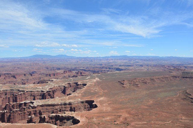

 We spent a night in Moab and, even though we were in a commercial campground, we were amazed at the millions of stars we saw – including, faintly, the Milky Way. It’s not just a matter of the big skies we’ve been privileged to view on this trip. It seems like communities are more conscious about light spillage but also don’t require (or allow?) the level of lighting that we are accustomed to in Springfield and the Midwest. Not sure how I feel about that. The darker skies and the abundance of stars are awe-inspiring but it’s also a bit uncomfortable, especially when walking around an unfamiliar community. I think I could get used to it. The stars are a big trade-off for the bright streets we have in Springfield.


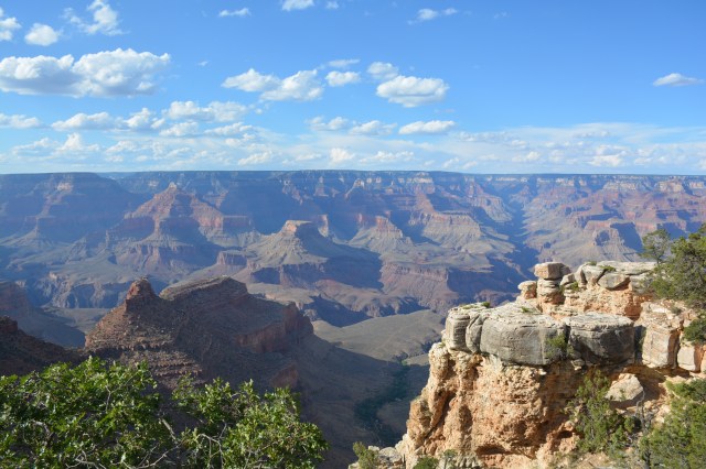
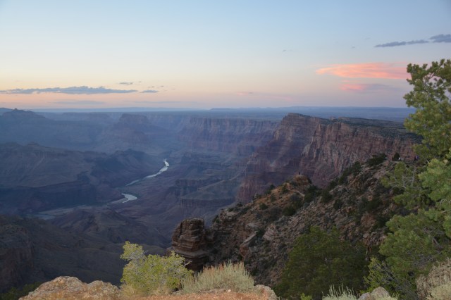
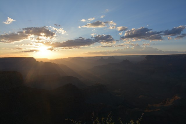
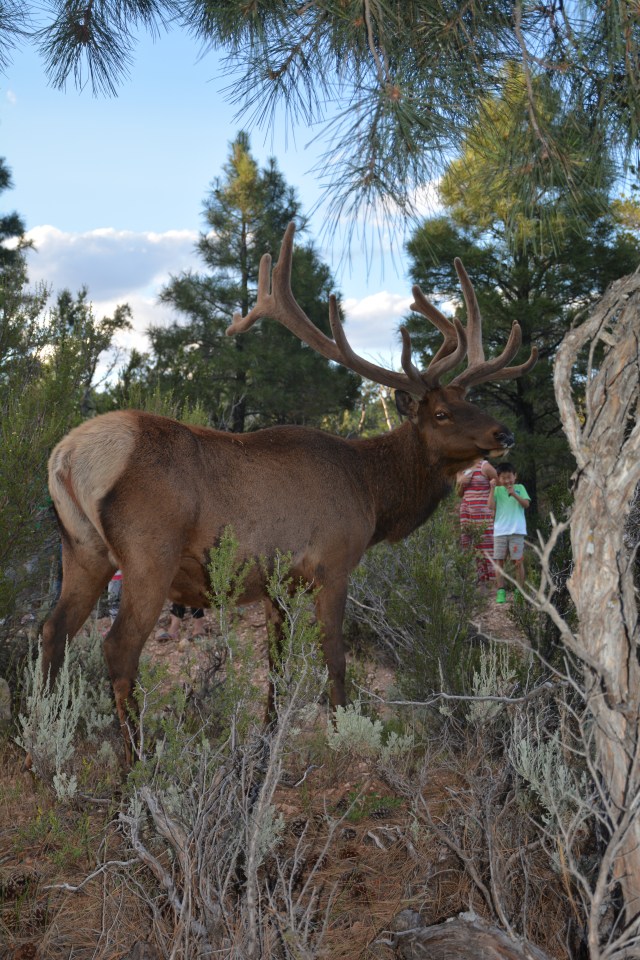
 I have mixed emotions about Grand Canyon. It is – huge. and unfathomable. But – we only viewed it from the rim and it was kind of a “okay, we’ve been there, done that” experience. I imagine I would have a totally different impression of the Grand Canyon had we hiked into it (and survived), taken a mule trip or rafted through it. Absent doing those things, we walked along the rim, fighting some of the 5 million people who visit annually – a significant portion of them seemingly visiting Fourth of July weekend when we did. We did stick around for sunset and watched it from the Desert View Watchtower lookout point. If you are merely looking at the Grand Canyon from the top, as we did, I recommend that you ditch the Grand Canyon Village scene and drive out to Desert View Watchtower. Not nearly so many crowds and the view is just as nice. You will have to drive, though, since the shuttle doesn’t go that far.